The top peak on the right is the actual turtleback. We hiked up and down the peaks until we to the foot of the last peak.
View of T or C with the Rio Grande river winding thru town. The plant in front is an Ocatillo. We walked thru a small forest of Ocatillos at lower elevations.
I like this picture because you can see my shadow taking the picture and also Katy taking a picture on the other side.
De rigueur group picture. From right to left, Katy, Marlin and Jim.
As we reached a little elevation Elephant Butte lake became visible. The sun appeared and disappeared in the clouds and made the colors of the lake change constantly from bright turquoise to a dark stormy grey.
There is the peak, finally.
This was a fabulous hike because of the terrain and especially because of the views. It felt like you could see all of the mountain ranges in New Mexico. The hike is not published in any NM hiking book that we know about. When we asked, the tourist office staff person told us it was a dangerous hike and strongly discouraged us. At the Riverbend Hot Spring office we were told that they had shredded all of the information with directions. They did give us verbal directions to the trailhead however.
Tuesday, January 24, 2012
Domingo Baca trail, Sandia Mountains, 1/8/2012
This hike starts from the Elena Gallegos Picnic Area and follows the Domingo Baca Canyon to the wreckage of the TWA flight that crashed in 1955. We do this hike regularly because we like the varied and rugged terrain that requires a bit of scrambling here and there.
The trail follows a streambed that divides into two at some point. At that point is a turnoff that we have missed more than once. Found it this time and hiked a little further than we usually do.
Plenty of snow and ice on the trail today. Pulled out our Yak Tracks and enjoyed the views.
The trail follows a streambed that divides into two at some point. At that point is a turnoff that we have missed more than once. Found it this time and hiked a little further than we usually do.
Plenty of snow and ice on the trail today. Pulled out our Yak Tracks and enjoyed the views.
Monday, January 23, 2012
Hawk Watch Trail, Sandia Mountains, 1/1/2012
This is an easy hike close to our home. We have done it many times but never tire of its beauty. The trail is named after Hawk Watch International because this is where the organization sets up camp every year from February 22 thru May 5 to count and bank migratory birds. The hike starts from Three Gun Trail into Three Gun Spring Canyon and then takes off east toward the saddle of the ridge.
Passage from the canyon over the east side of the ridge.
View of the crest.
We did this hike with our friends Katy and Marlin. And below, our lunch stop.
Passage from the canyon over the east side of the ridge.
View of the crest.
We did this hike with our friends Katy and Marlin. And below, our lunch stop.
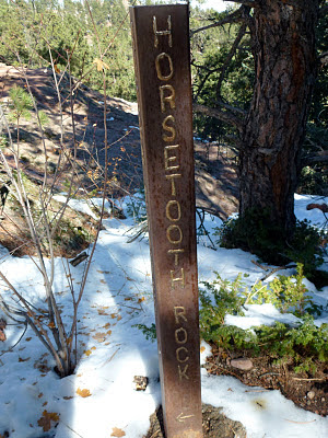
Horsetooth Rock, Loveland Colorado, 10/30/11
This was our Denver fall hike. We took Soderberg trail to Horsetooth Rock and returned via Audra and Southridge trails, about 5 miles round trip.
Horsetooth Rock is located in the Horsetooth Mountain Open Space, west of Fort Collins. Legend has it that the rock is the remains of the heart of an evil giant, cut in two by the powerful Native American Chief Maununmoku, protecting his people from the giant's wrath. Settler's however thought it looked more like horse teeth and is the name that stuck.
We had the good luck of finding two deer just on the side of the trail, enjoying the last of the fall's greenery.
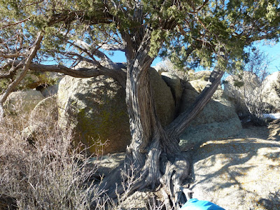
No, I did not rotate this picture. That is how the tree grew.
It was only October and the snows had already fallen.
This was a very busy trail with lots of hikers and their dogs.
The ascent to the rock required a climb...
... and as we reached the top we were rewarded by fabulous views with Pikes Peak to the south, Longs Peak and Rocky Mountain National Park to the west, Wyoming to the north and the Great Plains to the east. Altogether a great hike and well worth the effort.
Thursday, January 12, 2012
Mount Pilatus, Lucerne, Switzerland, 9/17/11
Our origanal plan was to take the cog train to the top of Mount Rigi, stay overnite and watch the sun rise. We changed downsized our romantic plans however when we found out the exobitant price to ride the train. Instead, we rode the bus from Lucerne to Kriens, took the cable car to the second station of Mount Pilatus (2132m) and walked down. The legend has it that Mount Pilatus is named after Pontius Pilatus but it is more likely that the name is derived from the latin "pilaetus" meaning cloud covered. As you can see, the day was hazy and rain fell a couple times as we hiked down.
As we stepped of the cable car, we discovered the Switzerland's longest summer toboggan run. Lake Lucerne is in the background.
Starting our descent.... passing thru open meadows,
and forrested land.
We saw several communal wood piles, all neatly stacked and numbered.
And, of course, all across the open meadows, we passed Swiss cows with their very loud, constanly clinging bells. The bells can be heard a long time before the cows can be seen.
Sunday, October 9, 2011
Menaggio Daily Trek, Lake Como, Italy, 9/23/2011
As part of our European trip, we rented an apartment for 5 days in Menaggio, a small town on the western shore of Lake Como in Italy. The apartment was situated about in the middle of town. The shops, bus and ferry were located along the lake shore, so every day we trekked back and forth from our apartment to the center. This meant passing thru a pedestrian tunnel and descending about 4 steep narrow alleys. I counted the steps of the one in the above picture: 110.
Italians, including elderly people, pregnant women and women with strollers, seemed to have difficulty handling the steep street. And indeed, after 5 days in Menaggio, just as it was time to leave, it felt a little easier to hike back and forth.
Menaggio was an ideal spot for us to stay for a few days. It offered everything we like: access to mountain hiking, to shops within walking distance and to culture to boot with the many historical sites, villas and gardens accessible via ferry.
Rifugio Menaggio, Lake Como, Italy, 9/21/11
The picture above is taken from the ferry from Menaggio to Bellagio. To reach the trailhead we took a bus from Menaggio to Breglia (749 m). The bus route passed several villages nestled on the mountain side. To see the route, follow the villages from left to right on the picture all the way up the little church of Breglia at the left edge of the picture. (The bus ride was an outing in itself. It provided great views of the mountain, lake and villages. The mountain roads are narrow and often allow passage for one car only. At sharp bends, the bus needs to honk to signal it approach to opposite traffic. After 2-3 days in Menaggio, we got used to the sound of the honking busses - part of life in a steep mountain village.)
As we gained higher altitude the lake receded in the background.
Almost there...
As we gained higher altitude the lake receded in the background.
Almost there...
Subscribe to:
Posts (Atom)
Patapsco CCC Remains trail, Patapsco State Park, MD, 10/23/24
Our first hike with Senior Rangers organized by Maryland Dept of Natural Resources. Actually, the fifth outing, as we missed some, and some...

-
Panoramic photo of approach to Dripping Springs Natural Area with Organ Mountains in background. A thriving resort in the early 190...
-
Missed today's Wednesday Mountain Club snowshoe and instead set out for a hike in the foothills, from the Menaul trailhead to some wa...
-
First of our micro hikes in the South Dakota Black Hills while visiting with Jim's grandson, Micheal. Above the Mount Rushmore rock car...


