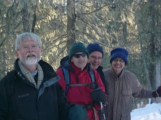
This hike was suggested by our friends Katy and Marlin. It starts at the turn off to La Luz Trail and makes a loop into Jaral Canyon. It is a short trail, 2.5 miles round trip, perfect for a winter mid-day hike. Although the slopes look bare in the picture above, we did encourter a fair amount of snow that allowed us to try out our cleats. Pyramid Peak is in the background.
The return loop followed a ridge with spectacular views and steep canyon walls.
Wednesday, January 27, 2010
Monday, January 18, 2010
Valles Caldera Snowshoe
The Valles Caldera National Preserve, about to become a National Park, is the location of an old filled-in volcano. Caldera means "kettle" in Spanish. Imagine a very large idyllic meadow (Valle Grande) rimmed on the edges. The mount above, in the middle of the Valle Grande is called Redondo Peak and is considered a sacred mountain by native tribes in the region. Because of its vast expance of flat and hilly terrain, the Valle Grande attracts cross-country skiers and snowshoers alike. (Besides being an attraction for skiers, hikers and tourists, the Valle Caldera is also a money-making cattle ranch and the location of scientific and archeological digs.)

No need to stay on groomed trails. Here is Jim blazing trail in snow that was over a foot deep. (Yes, it is hard work and we took turns.)
View from the southwest edge of the Caldera with an old western movie set called "Missing Movie Set" in the background. We saw a number of animal tracks, birds, elk, deer, cayotes and, of course, dogs. Any guess about what the tracks above could be? Rabbit?
Spence Hot Springs
Rather than go home immediately in the morning (January 18, 2010 Marting Luther King Day) after an overnite stay at the Elk Mountain Lodge in Jemez, we decided to hike up to Spence Hot Springs. Although it is a very short hike in, we did have to find our way around a trail that had turned into a river of ice.
As we got closer to the springs, the ice and snow disappeared, replaced by watercress growing at the stream's edge... in January!
Our reward...
As we got closer to the springs, the ice and snow disappeared, replaced by watercress growing at the stream's edge... in January!
Our reward...
Monday, January 11, 2010
Columbine Creek Trail, Carson National Forest
On our second day of snowshoeing, we decided to explore a "real" trail. This trail starts at Columbine Campground and is located about 8 miles west of Red River on State Highway 38. It is about 8 miles long and follows Columbine Creek. We crossed 4-5 picturesque Japanese-looking bridges. Above is a view of the sparking clear water and ice formations we encountered all along the trail.
We made it in about 2-2.5 miles when we decided to stop for lunch. Geoff and Patty enjoying sandwiches made with Marlin's New Year's Day southern BBQ'd chicken. As you can see, no need for gloves. It was a warm, comfortable day with exceptional scenery. In indian file, Geoff, Marlin, Jim, Katy and Patty.
Most of us took a tumble at some point. Here is Geoff taking a turn.
Enchanted Forest Cross Country Ski Area
On the way to snowland, 6 of us converged to traverse the trails... so said Jim. We spent a wonderful w.e. snowshoeing with friends in Red River, NM, just north of Taos. On our first day, which was a maiden run for Katy (in picture below), Marlin, Geoff and Patty, we explored the groomed trails at the Enchanted Forest Cross Country Ski Area.
The outing was a success, except for one casualty, a broken ski pole, easily fixed with duct tape...
Plenty of children on the trail, warm and comfortable in their enclosed small sleds, pulled by their parents...
Another group picture with Patty taking the picture....
The outing was a success, except for one casualty, a broken ski pole, easily fixed with duct tape...
Plenty of children on the trail, warm and comfortable in their enclosed small sleds, pulled by their parents...
Another group picture with Patty taking the picture....
Subscribe to:
Posts (Atom)
Wincopin trail, Savage Park, MD, 4/16/2024
Midweek afternoon stroll along the Wincopin red trail in the company of Master Gardener Ann Coran, who invited us on a spring wildflower hun...

-
Panoramic photo of approach to Dripping Springs Natural Area with Organ Mountains in background. A thriving resort in the early 190...
-
The Mora Flats are a large marshy meadow crossed by several streams. Starting from Iron Gate Campground (18 miles in on NM 63, past the to...
-
We lucked out on this hike! The whole area is closed to hikers from March 1 to August 15 to protect wildlife. Fletcher trail, 4 miles ...


