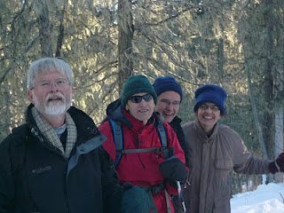
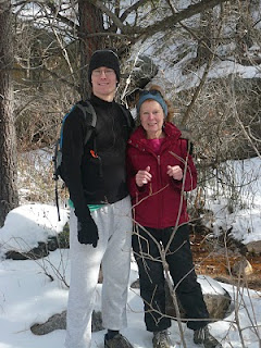
Rather than go home immediately in the morning (January 18, 2010 Marting Luther King Day) after an overnite stay at the Elk Mountain Lodge in Jemez, we decided to hike up to Spence Hot Springs. Although it is a very short hike in, we did have to find our way around a trail that had turned into a river of ice.
As we got closer to the springs, the ice and snow disappeared, replaced by watercress growing at the stream's edge... in January!
Our reward...
Monday, January 18, 2010
Monday, January 11, 2010
Columbine Creek Trail, Carson National Forest
On our second day of snowshoeing, we decided to explore a "real" trail. This trail starts at Columbine Campground and is located about 8 miles west of Red River on State Highway 38. It is about 8 miles long and follows Columbine Creek. We crossed 4-5 picturesque Japanese-looking bridges. Above is a view of the sparking clear water and ice formations we encountered all along the trail.
We made it in about 2-2.5 miles when we decided to stop for lunch. Geoff and Patty enjoying sandwiches made with Marlin's New Year's Day southern BBQ'd chicken. As you can see, no need for gloves. It was a warm, comfortable day with exceptional scenery. In indian file, Geoff, Marlin, Jim, Katy and Patty.
Most of us took a tumble at some point. Here is Geoff taking a turn.
Enchanted Forest Cross Country Ski Area
On the way to snowland, 6 of us converged to traverse the trails... so said Jim. We spent a wonderful w.e. snowshoeing with friends in Red River, NM, just north of Taos. On our first day, which was a maiden run for Katy (in picture below), Marlin, Geoff and Patty, we explored the groomed trails at the Enchanted Forest Cross Country Ski Area.
The outing was a success, except for one casualty, a broken ski pole, easily fixed with duct tape...
Plenty of children on the trail, warm and comfortable in their enclosed small sleds, pulled by their parents...
Another group picture with Patty taking the picture....
The outing was a success, except for one casualty, a broken ski pole, easily fixed with duct tape...
Plenty of children on the trail, warm and comfortable in their enclosed small sleds, pulled by their parents...
Another group picture with Patty taking the picture....
Tuesday, December 29, 2009
Domingo Baca Hike
This hike travels into the Domingo Baca Canyon on the west side of the Sandias and is 3.5 miles long, one way. (Elevatation 2360 feet) It leads to the wreckage of a TWA flight that crashed on 1/19/1955. The trails starts in sandy terrain strewn with rocks and boulders, leading up a an arroyo which had flowing water partially covered with ice.
We marveled over snow flakes, icicles and rocks covered in slick, thin sheets of ice.
We marveled over snow flakes, icicles and rocks covered in slick, thin sheets of ice.
Sunday, November 15, 2009
Piedra Lisa Trail
We did South Piedra Lisa trail today to Rincon Ridge, about 2 miles up. This hike has splendid views on both sides of the trail, with Albuquerque to the west and impressive granite formations to the east. As you can see from the picture above, it was snowing as we set out.
By the time we reached Rincon Ridge, the snowcloud had lifted just enough above the horizon to show bright sunny views to the north.
One of the many impressive granite formations, the Shield (I think).
City views on the way back.
By the time we reached Rincon Ridge, the snowcloud had lifted just enough above the horizon to show bright sunny views to the north.
One of the many impressive granite formations, the Shield (I think).
City views on the way back.
Saturday, November 14, 2009
La Luz Trail - October 24, 2009
We decided it was time to do one of our yearly pelgrimages... La Luz Trail, 7.5 miles one way, 3210 feet elevation. You can see the radio towers at the top. Our goal was the Upper Tramway Terminal to the south of the towers. It was a gorgeous fall day with a kaleidoscope of colors... There were 3 of us on this hike; we invited our friend Mark to join us on this outing.
View from Chimney Canyon with Aspen in full fall color...
Surprise, surprise! We started to notice patches of snow past the 5-mile mark and soon we were plowing through soft snow (no ice!) just about all the way to the top.
We did it!
View from Chimney Canyon with Aspen in full fall color...
Surprise, surprise! We started to notice patches of snow past the 5-mile mark and soon we were plowing through soft snow (no ice!) just about all the way to the top.
We did it!
Subscribe to:
Posts (Atom)
Patapsco CCC Remains trail, Patapsco State Park, MD, 10/23/24
Our first hike with Senior Rangers organized by Maryland Dept of Natural Resources. Actually, the fifth outing, as we missed some, and some...

-
Panoramic photo of approach to Dripping Springs Natural Area with Organ Mountains in background. A thriving resort in the early 190...
-
Missed today's Wednesday Mountain Club snowshoe and instead set out for a hike in the foothills, from the Menaul trailhead to some wa...
-
First of our micro hikes in the South Dakota Black Hills while visiting with Jim's grandson, Micheal. Above the Mount Rushmore rock car...


